A ship’s most important timetable could be written in the weather. Across parts of the Indian Ocean, seasonal changes in prevailing winds helped sailors move in different directions at different times of year. For merchants, that pattern affected far more than departure. It shaped when goods arrived, how long money remained committed to a voyage, where travellers waited and which relationships had time to develop ashore.
The familiar phrase “monsoon trade” can make this sound simple: one wind carried a ship out, another brought it home. The underlying pattern mattered, but actual navigation was more demanding. Regions differed, transitions were uneven, currents and storms complicated passages, and crews needed practical knowledge. The monsoon was a resource to work with, never an automatic delivery service. Understanding it means joining atmospheric change to human planning. 1
PLACE & TIME
Northern Indian Ocean · c. 1000–1500 CE
A monsoon is a seasonal circulation
In everyday speech, “monsoon” often means heavy rain. For the history of navigation, the seasonal organization of winds is the crucial point. Temperature and pressure differences between land and sea help drive broad changes in circulation, although the full atmospheric system is more complicated than a single landmass warming up. Rain accompanies important parts of the cycle; it does not define every maritime consequence. 1
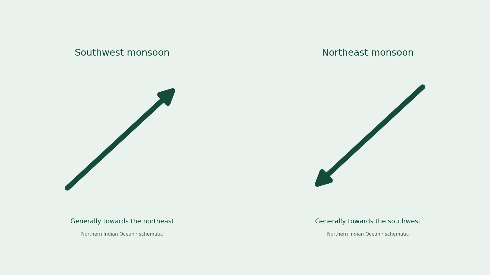
Over much of the northern Indian Ocean, southwest winds are associated with the summer season, while northeast winds characterize much of winter. A wind is named for the direction from which it comes. A southwest wind therefore blows generally towards the northeast. That convention is easy to overlook when reading a map, and reversing it can make a historical itinerary appear to run against the very wind supporting it.
TERMS
Words that change the question
Monsoon
A seasonal circulation pattern; rain is one consequence, not the whole definition.
Prevailing wind
A commonly recurring direction, not a promise of identical conditions every day.
Roadstead
An offshore anchorage; landing may involve smaller craft and additional coordination.
The pattern is not uniform across the whole ocean. The Arabian Sea, the Bay of Bengal and the waters off East Africa have different coastal orientations and regional conditions. Farther south, trade winds and the movement of air across the equator add another layer. “Summer” also means different seasons in the two hemispheres. A useful explanation names a region and direction instead of giving every coast one universal sailing calendar. 2
Nor did a seasonal change happen everywhere on a single date. A broad climatological pattern describes recurring tendencies, not a guaranteed wind at a named harbour on a particular morning. Historical crews worked with observable conditions and accumulated experience. Their decisions were practical responses to a variable environment, even when those decisions followed a familiar annual rhythm.
- Name the region before applying a seasonal pattern.
- Remember that a wind is named for where it comes from.
- Treat recurring conditions as tendencies rather than a daily promise.
Predictability gave merchants a planning horizon
The great advantage was recurrence. If favourable conditions usually returned in a recognizable part of the year, people could arrange supplies, finance and cargo around that expectation. Seasonal regularity made repeated voyages possible without making individual voyages safe. The distinction resembles the difference between knowing that a road normally opens each spring and knowing that no journey along it will encounter a landslide.
A merchant also had to think beyond a ship’s first destination. Reaching a port at the wrong stage of the cycle might complicate the next leg or delay return. Cargo could arrive when buyers were numerous, when competing ships had already unloaded, or when local production had not yet supplied the desired goods. A sailing decision therefore linked weather to market timing without allowing either to determine the other completely. 2
FOLLOW THE CONNECTION
Plan the whole sequence
Direction
Identify the region, intended movement and likely seasonal conditions.
Departure
Assemble a capable crew, supplies, cargo and practical knowledge.
Arrival
Use local services and negotiate within the destination’s arrangements.
Return or onward travel
Allow for waiting and conditions on the next leg, not only the first crossing.
Planning operated at several scales. A crew might exploit a local coastal wind for a short movement while remaining within the broader seasonal window for an ocean crossing. A merchant could send goods onward without personally making every leg. Another participant might specialize in a regional connection rather than a complete outward and return circuit. Repeated patterns did not force everyone into the same itinerary or business model.
For that reason, a map with long arrows needs interpretation. An arrow can summarize a direction of exchange across centuries, but it cannot tell you whether one ship followed the entire line. It may combine successive transactions and voyages. Monsoon knowledge helped connect those segments; the historical task is to discover which movements are actually supported in a particular period.
- Distinguish a mapped connection from one demonstrated voyage.
- Allow for different participants handling different legs.
- Include the next destination in the timing question.
Waiting was part of the voyage
Time ashore was not simply empty space between adventures at sea. A traveller might wait for conditions that made onward movement more practical. During that interval, lodging, food, storage, credit and protection mattered. A port offered services as well as goods. Hosts and intermediaries could turn a seasonal interruption into a durable relationship, while someone with limited resources might find the same delay costly and precarious.
Waiting also gave language and trust time to develop. A visitor returning repeatedly to the same port could learn who handled a commodity reliably, which authority resolved disputes and how local measures were used. None of this requires a romantic picture of strangers becoming friends. Commercial dependence could build cooperation through repeated dealings while leaving participants suspicious, unequal or vulnerable to political change.
- A delay could create opportunities to trade, learn and form connections.
- The same delay could consume provisions, tie up capital and expose a traveller to risk.
- People controlling accommodation, storage or credit could benefit from visitors’ dependence.
The seasonal rhythm therefore affected urban society. Some residents worked in activities that intensified when ships arrived. Others provided goods needed all year but found particular demand during a trading season. We should not infer a precise workforce or annual festival from the existence of this rhythm. The secure point is a relationship: a port’s services helped visitors remain until movement became feasible again.
A favourable wind still needed a capable crew
Sailing involved more than pointing a vessel along an arrow. Crews had to manage sails, balance cargo, maintain the hull and respond to conditions near land. Open-water navigation required knowledge of direction and position, while landfall demanded attention to reefs, shoals and approaches. Different vessels and routes called for different combinations of skill. Broad descriptions of “the dhow” can hide substantial diversity in boats and construction traditions. 2
That diversity also discourages a neat ladder of progress from supposedly primitive local craft to European ships. A vessel suited to one coast or cargo might be poorly suited to another task. Shipbuilding knowledge and navigational practice circulated, adapted and persisted through contact. Historical effectiveness should be assessed against the voyage a vessel was meant to undertake, rather than against one later model of maritime technology.
KEY IDEA
A recurring wind was a resource, not a guarantee
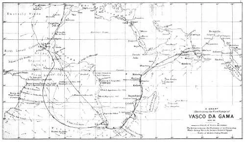
A pilot’s expertise could be decisive. The journal of Vasco da Gama’s first voyage records that a pilot was obtained at Malindi before the crossing to India. The episode shows Portuguese dependence on knowledge available within the ocean’s existing networks. The surviving account does not justify the popular identification of that pilot with the famous navigator Ahmad ibn Majid. A needed skill and an uncertain personal name should remain separate. 3
This dependence helps explain how outsiders could enter established routes quickly. They did not need to discover every relevant feature independently. They could obtain assistance, learn from repeated encounters and adapt existing knowledge to their purposes. That process could support peaceful exchange, coercive intervention or both. Expertise itself did not prescribe the politics of the people using it.
- Recognize the local expertise behind a newcomer’s successful crossing.
- Keep an uncertain pilot’s identity separate from the evidence of assistance.
- Ask how acquired knowledge was subsequently used.
Currents, coasts and storms complicated the pattern
Wind moves air; currents move water. Their relationship matters to a ship, but they are not interchangeable. Seasonal circulation can affect ocean currents, and local tides create additional movement near coasts. A route that looks attractive on a wind chart may involve difficult landfalls or water moving against the intended course. Experienced navigation combines these considerations rather than treating any single environmental feature as sufficient. 2
Storms add another reason to avoid a mechanical model. A favourable seasonal direction does not rule out violent weather. Ibn Battuta’s account of events at Calicut describes a planned departure disrupted by severe conditions and losses. It is an account written after the event, with its own narrative purposes, but it still illustrates a fundamental distinction: being within a trading world organized by seasonal winds did not remove danger at the anchorage. 4
COMPARE
A pattern and a passage
Scale
Recurring regional tendencies.
One crew, cargo and sequence of conditions.
Planning
Provides an expected window.
Requires decisions as conditions unfold.
Evidence
Climate and navigation studies.
A bounded narrative or material record.
Ports could differ in the protection they offered. An open roadstead, a sheltered channel and an estuary presented different practical problems. A large ship might anchor offshore while smaller craft moved people and cargo. Such arrangements created another layer of labour and coordination between ocean sailing and the transaction ashore. The coastline was not a simple boundary where a voyage ended and commerce began.
These differences mattered economically. Moving cargo through several vessels or storing it while conditions changed involved costs, expertise and opportunities for dispute. The monsoon shaped the broad window of movement, but harbour arrangements shaped what happened when a ship reached land. To explain trade well, keep both scales in view: the atmospheric system and the specific place where goods changed hands.
- Identify the harbour arrangement as well as the open-water route.
- Include the handling between vessel and shore.
- Consider costs created by storage and delay.
Goods had their own calendars
Weather was not the only source of timing. Agricultural production, inland transport, craft manufacture and political requirements affected when goods were available. A port could receive ships without having the desired cargo ready. Conversely, goods assembled for export might remain in storage awaiting a suitable departure. Synchronizing these rhythms was a commercial problem involving people far from the sea.
Some commodities tolerated delay better than others. A durable ceramic vessel and a perishable foodstuff presented different storage concerns. Valuable compact goods and bulky provisions created different problems of space and handling. We should not convert these general differences into unsupported claims about exact medieval profit margins. They explain why merchants needed to evaluate a cargo as a set of physical things, not merely as a list of desirable names.
TIME
A sequence with boundaries
- Before departure
Preparation
Cargo, supplies and knowledge are assembled.
- At sea
Conditions
Crews work with wind, water and hazards.
- At a port
Waiting and exchange
Services and relationships make a stay possible.
- Next opportunity
Movement resumes
The next leg has conditions of its own.
A sequence, not universal departure dates
Credit and partnership could distribute the consequences of delay, though arrangements varied by place and period. Someone might provide money, someone else transport, and another participant manage sale at a destination. Seasonal risk then entered relationships among people as well as the movement of a ship. The familiar image of one bold captain owning the entire venture is only one possible arrangement and should not stand for the whole ocean.
A trading system could therefore be regular and uncertain at the same time. People expected recurring opportunities, but outcomes depended on supply, demand, weather and authority. That combination encouraged practical flexibility. It also explains why a network could persist through disruption: different participants might adjust routes or transactions without requiring every connection to operate continuously.
Seasons made contact possible, not equal
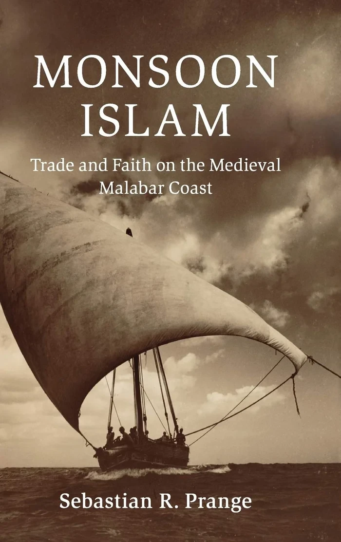
Repeated arrivals helped bring Muslim merchants, scholars and travellers into contact with communities around the ocean. Religious practices and institutions could offer familiar points of orientation. Along the Malabar coast, commerce and Muslim community life developed within regional political settings rather than through one uniform oceanic government. Sebastian Prange’s work frames these connections as relationships between trade, faith and local authority. 5
However, neither shared religion nor seasonal interdependence guaranteed tolerance. A ruler might favour one group, merchants might compete, and visitors could have more bargaining power than local suppliers. Enslaved people also moved within maritime networks. Their journeys cannot be described as voluntary participation simply because the same winds carried them. Physical connection tells us little by itself about freedom, security or the distribution of benefits.
- Who could decide when to travel?
- Who paid for a prolonged stay or a lost cargo?
- Who controlled the services a stranded visitor needed?
These questions move an environmental explanation towards a social one. Winds affected everyone aboard a vessel, yet people experienced their consequences from different positions. A financier, sailor, passenger and captive could share a passage without sharing either its purpose or its rewards. The seasonal system becomes historically meaningful when those differences are kept visible.
What the monsoon can explain
The monsoon helps explain why repeated exchange across substantial distances was practical, why timing mattered and why waiting places became important. It cannot, by itself, explain why one port prospered more than another, why a particular ruler gained influence or why violence intensified at a given moment. Those questions require political, economic and local evidence. Climate establishes possibilities within which historical choices are made.
This also prevents an exaggerated story of timelessness. Seasonal winds recur, but the societies using them change. Ships, commodities, institutions and balances of power differed across the centuries. A climatological pattern connecting a tenth-century voyage to a sixteenth-century one does not make their passengers or purposes identical. The ocean’s recurring rhythm provided continuity while permitting very different histories.
When you next see a map of Indian Ocean trade, read its arrows as questions. Which season supported the movement? Where did people wait? Did a route involve one voyage or several? Who supplied the knowledge, food and political permission that made it work? The winds mattered enormously. Their significance becomes clearer when we see the arrangements people built around them, turning recurrent conditions into a complicated, enduring field of human connections.