A clay tablet fits into the palm of a hand. A brick well belongs to a building and reaches down into the ground. One makes quantities durable; the other makes water accessible. Neither looks much like the grand skyline we might imagine when we hear about the first cities. Yet both bring us closer to the work that kept a crowded settlement going.
At Uruk, in southern Mesopotamia, early accounts helped organise goods. At Mohenjo-daro, in the Indus region, wells and drains connected everyday tasks with the built environment. Read together, these traces suggest a useful way into our final question: what made urban life possible, and who carried its burdens? Start with what had to happen again tomorrow, rather than what could be built once.
PLACE & TIME
Two urban settings, overlapping histories
Uruk · Mohenjo-daro · Ur
Southern Mesopotamia and the Indus region
c. 3500–1800 BCE
The comparative setting
A city reaches beyond its buildings
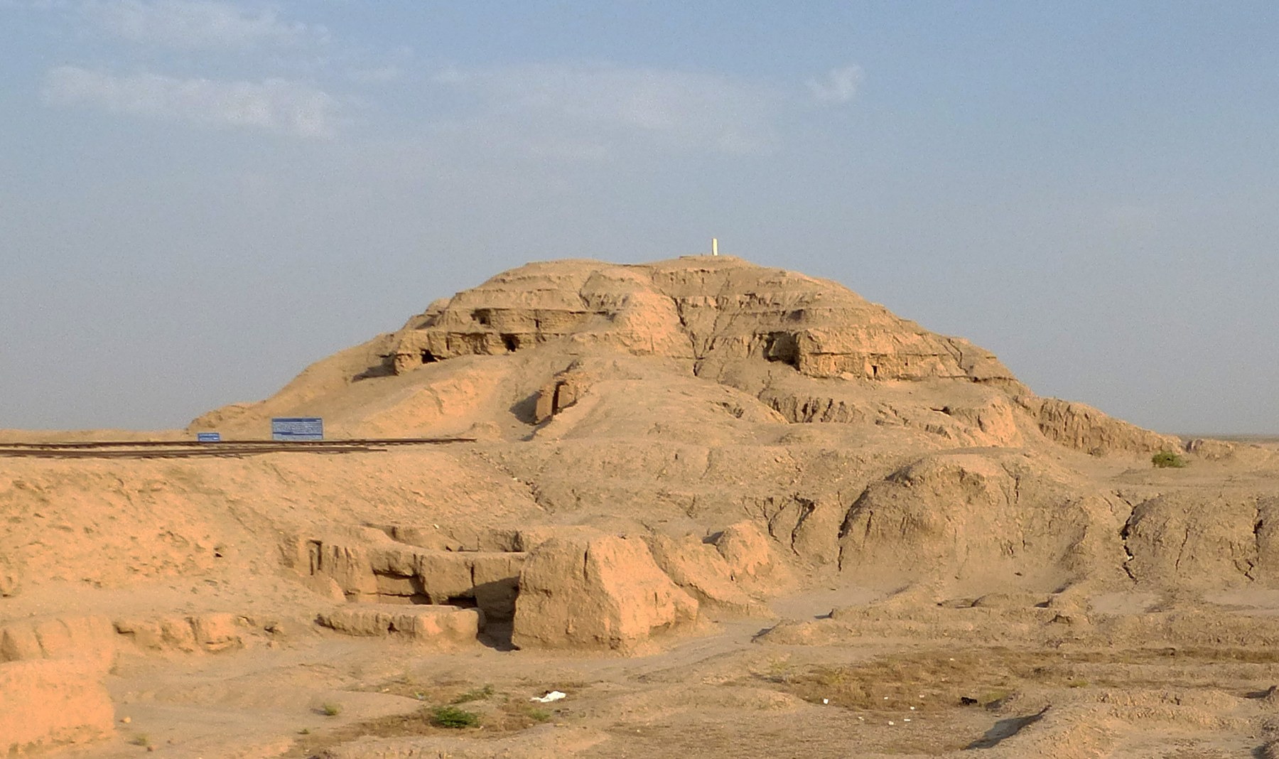
By around 3200 BCE, Uruk was a major urban centre with monumental mud-brick buildings and records of goods and workers’ rations. Mohenjo-daro’s best-known urban phase belongs to the Mature Harappan period, c. 2600–1900 BCE. The comparison is not between two settlements invented at the same instant. It follows different urban histories whose periods overlap.
Population and buildings matter, but neither gives the whole picture. Ask how the people concentrated in one place obtained food, materials and skills. A neighbourhood could contain a potter, a household preparing meals and a place for managing deliveries; their tasks did not become identical because they shared streets. Urban life brought activities close together while connecting them to work elsewhere.
LAYERS OF TIME
Compare the periods before comparing the cities
- By c. 3200 BCE
Uruk is a major city
Monumental buildings and early accounts make concentrated activity visible in southern Mesopotamia.
- c. 2600–1900 BCE
Mohenjo-daro’s mature urban phase
Houses, wells, streets and drains form part of the Mature Harappan urban world.
- c. 2004 BCE
Ur III ends
The fall of a kingdom changes authority in southern Mesopotamia without ending every city’s later history.
- c. 1850 BCE
A later household at Ur
An excavated house gives a much later view of food preparation, storage and teaching.
These dates orient the comparison. They do not date every building in the photographs or imply that one city caused another.
This is why the first city in our path cannot be understood in isolation. The surrounding landscape and settlements were part of its working world. The term hinterland names that wider area of connections; it does not mean an empty margin waiting for the city to give it a purpose. Fields, herds and people outside the dense settlement belong in the story from the beginning.
Food becomes urban through a chain of work
The early account pictured below dates to c. 3100–2900 BCE and probably comes from Uruk. The Met interprets it as likely recording grain distributed by a large temple. Its incised signs and impressed marks turn a perishable movement of goods into a durable object. The absence of verbs in early texts makes the precise reading difficult: “likely” belongs to the catalogue’s interpretation, not to a story invented from the photograph.
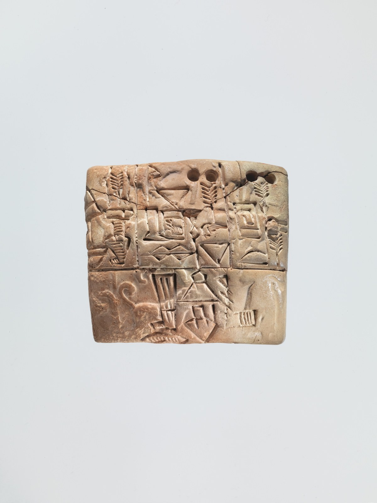
Follow that grain backwards. Before anyone could enter a quantity on clay, food had to be produced and brought to a place where it could be distributed. Follow it forwards, and it had to reach people who would process or consume it. The account catches one part of this movement. It invites us to connect the visible act of recording with the less visible work on either side.
Those connections matter more than a simple contrast between farmers and city dwellers. Producing, carrying, storing and preparing food are different jobs, and some could happen within urban households. In later Mesopotamian evidence, temple and royal sectors existed alongside household production and exchange. A city was not one enormous institution, even when its institutional records dominate what survives.
FOLLOW THE PROCESS
Read a food account in both directions
Start with production
Ask where the recorded food came from and whose work made it available.
Follow its movement
Look for evidence of transport, delivery and storage between production and use.
Identify the recorded transaction
Separate the quantity or distribution the text records from the whole economy around it.
Return to the recipient
Ask who received supplies and what the record leaves unmentioned about preparation and consumption.
This is a way of investigating an account, not a reconstructed itinerary for the pictured grain. It also changes the question we ask of an impressive storehouse or public building. Capacity alone cannot tell us who controlled access. The building becomes more revealing when we can connect it with deliveries, recipients and obligations. A later tablet from Nippur records copper knives issued to individuals: an urban object can carry a history of allocation as well as manufacture.
Water makes the neighbourhood visible
Mohenjo-daro offers another route into dependence. Its numerous wells brought water sources into the built settlement. Drawing water was still a task; a well did not deliver it automatically to every person who needed it. Access, carrying and use belong between the source and the household activity. The convenience of nearby water should not erase the work of obtaining it.
LOOK CLOSELY
A well is a structure people had to use
Follow the circular construction
Repeated courses of brick form the well shaft. The object is a built water source, not simply a hole in a city plan.
Look beyond the exposed height
Excavation has removed surrounding deposits. The standing cylinder should not be read as a tower that Bronze Age users necessarily climbed.
Ask about access
The photograph locates one structure. Wider archaeological descriptions are needed to distinguish public access from wells within buildings.

An exposed brick well at Mohenjo-daro, photographed in 2010. Excavation can leave a well standing above removed occupation deposits; this photograph alone does not date every visible course.
Once used, water raised a shared spatial problem. Archaeological descriptions connect bathing-floor outlets with street drains, some covered with bricks or stone. Settling traps collected material that had to be removed, and drains were modified over time. Here the city appears through interfaces: a surface inside a house, an outlet crossing its edge and a channel in shared space.
Construction made these connections possible; cleaning and repair helped keep them useful. That distinction is an inference from the described structures and maintenance traces, not a surviving municipal job list. It is nevertheless central to our question. A neighbour’s outlet and a street channel belong to the same practical problem, even when archaeology cannot identify the person responsible for each part.
- A water source has to be reachable.
- A household outlet has to connect with somewhere for water to go.
- A shared channel has to remain usable as deposits collect and buildings change.
Shared knowledge can take different forms
At Uruk, clay accounts made information persist beyond an individual conversation. Early lists also distinguish offices and specialised occupations. Written signs were part of an increasingly differentiated urban world. Keeping a record offered possibilities for checking and comparison, but someone had to learn the system and someone had to interpret the marks. A tablet did not make its contents equally accessible to everyone.
In the Indus region, graduated cubical weights provide another material clue to shared practices. Kenoyer describes examples excavated at Harappa in a recurring system of ratios. Their use in trade is plausible; tax collection is a possibility, not a certainty. These particular objects are from Harappa, not Mohenjo-daro. They help place the latter city within a wider regional world without making every Indus site interchangeable.
KEY IDEA
An account, a weight and a drain reveal different ways that people’s tasks could connect.
The same caution applies to writing. Indus inscriptions are short and remain undeciphered. Their survival establishes the use of signs, but does not provide the readable administrative biographies that we sometimes have in Mesopotamia. We cannot fill that gap with a list of imagined kings, laws or departments. We can investigate patterns of objects and buildings while keeping the unanswered questions visible.
Organisation leaves traces; authority needs its own evidence
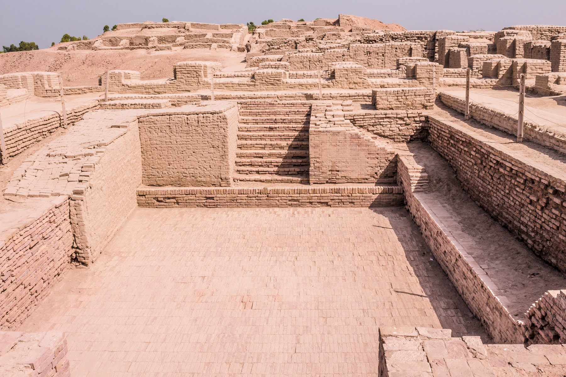
The Great Bath at Mohenjo-daro makes coordinated construction unmistakable. Its finely fitted bricks, plaster and bitumen helped make the tank watertight. Steps and surrounding access organised movement around it. Religious use is a scholarly interpretation of the building. Neither its engineering nor its familiar modern name supplies an ancient admission policy or the identity of whoever commissioned it.
In Mesopotamia, images and inscriptions often bring rulers into view, and monumental and royal evidence differs from the surviving Indus pattern. That difference deserves attention. But a recognisable king is not the only possible explanation for coordination, and the lack of a securely identified royal palace at Mohenjo-daro does not prove that its inhabitants had equal wealth or power.
KEEP THE DISTINCTION
A shared task is not a complete political system
Food and materials
Accounts and distribution records can identify particular goods, quantities and allocations in Mesopotamia.
Who obtained supplies outside that recorded transaction, and how the burdens were divided across households.
Water and shared space
Wells, household outlets and street drains connect activities with structures at Mohenjo-daro.
Which people managed access, ordered repairs or performed the work in a particular neighbourhood.
Knowledge and authority
Writing, recurring measures and coordinated buildings show organised practices in different settings.
The precise offices, enforcement arrangements and political relationships behind each practice.
The distinction keeps the comparison useful. It lets us ask the same practical questions in two settings without forcing both into a single model of the state. Archaeological organisation and political interpretation are connected, but not identical. The missing piece should guide the next investigation rather than become an excuse to insert the system we expected to find.
Who carried the city’s burdens?
A ration account makes the recipient visible as part of an organised transaction. A monumental building displays a completed result. Neither automatically gives us the worker’s account of the arrangement. The records and ruins can show provision, allocation and construction while leaving coercion, negotiation and household effort much harder to reconstruct. We should resist treating “it worked” as the same statement as “everyone benefited equally.”
This is also a question of where we look. A ruler’s achievement, a household’s convenience and a producer’s obligation belong to different scales of the same urban world. The following perspectives are questions prompted by the evidence, not invented voices of named residents. Keeping them together prevents the finished monument from absorbing the whole history of the work that made it possible.
CHANGE THE VIEW
One urban task, several questions
Follow food or materials towards the city. Ask what is known about the obligation or exchange, rather than assuming every delivery was a free sale or every producer lived outside the settlement.
Drawing water and preparing food bring urban systems into daily use. A delivery or a well is a starting point for household tasks, not a complete account of how people lived.
An account can make a transaction available to an institution. That visibility helps explain administration, while the unrecorded work around it remains a separate historical question.
The surviving evidence does not let us produce a balance sheet of comfort and hardship for everyone in Uruk or Mohenjo-daro. It supports a more precise conclusion: urban advantages rested on work, access and obligations that must be investigated separately. Nearby water, concentrated skills and durable records could create opportunities; their existence alone cannot settle who enjoyed them or on what terms.
A city has to be made again
The last chapter of this path followed the fall of the Ur III kingdom around 2004 BCE. That history gives the comparison a further dimension. Food, communication and authority can be connected through a political structure that later breaks apart. The end of that structure is a major rupture, but it is not automatically the final date of every city within it.
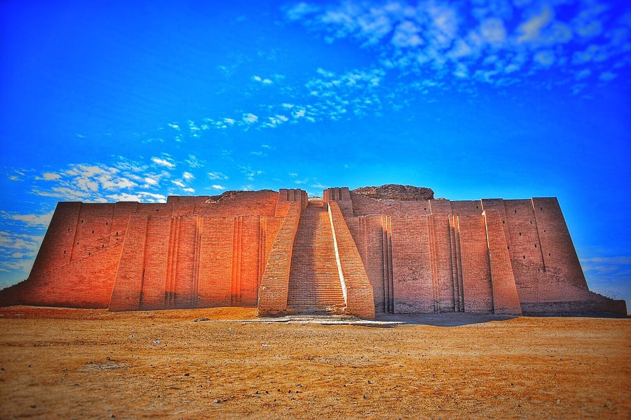
At Ur, an excavated elite household built around 1850 BCE contained spaces for storage, food preparation and teaching. Later alterations changed how rooms were used. The house is much later than the kingdom’s fall. It establishes a later chapter of activity rather than immediate recovery, and its well-connected occupants cannot represent every family’s experience.
What it adds to our opening question is the importance of time. A city was not made permanently functional by an original plan, one ruler or one technical invention. Buildings could be altered, skills taught and arrangements changed. Those later practices had to find people and resources under new conditions. Studying urban life therefore means following renewal and loss as carefully as the first appearance of a famous structure.
- Ask when a structure or record belongs in the city’s history.
- Look for repeated use, maintenance and alteration as well as initial construction.
- Keep a kingdom’s political chronology separate from the later activities of its cities.
What made the first cities work?
Return to the account and the well. They do not offer a complete definition of the city, but they reveal relationships that a skyline can hide. Food had to move from production towards use. Water had to be reached and directed away. Knowledge had to become usable by other people. Authority could shape these connections, while households and producers carried tasks that official records only partly expose.
THE PATH’S ANSWER
The first cities worked through connections between work, resources, knowledge and authority.
Uruk and Mohenjo-daro give that answer different material forms. One brings early accounting into focus; the other lets us follow water through built spaces. The later history of Ur shows why those connections must also be studied through change. Together, they make the first cities less remote: not because their institutions were identical to ours, but because a magnificent result still asks a very practical question—whose work made it possible, and what had to happen next?