A city can store grain, count it and distribute it. But someone must first make the crop grow. In southern Mesopotamia, that meant bringing river water to land where rainfall alone could not reliably support farming.
Irrigation in ancient Mesopotamia was a chain of connections: take water from a river, carry it towards farmland, divide it between smaller channels and let it reach the soil. A blocked connection could make work elsewhere useless. The question was therefore both practical and social: how did water reach the fields, and who kept its route open?
PLACE & TIME
Girsu in the land of Lagash
Girsu / Tello
Southern Mesopotamia · Present-day Iraq
c. 2500–2300 BCE
Approximate period covered
The river was nearby. The useful water was not always.
Think of three different questions. Is there water in the landscape? Can it flow to this particular field? Will it arrive in the right amount when the crop needs it? A river answers only the first.
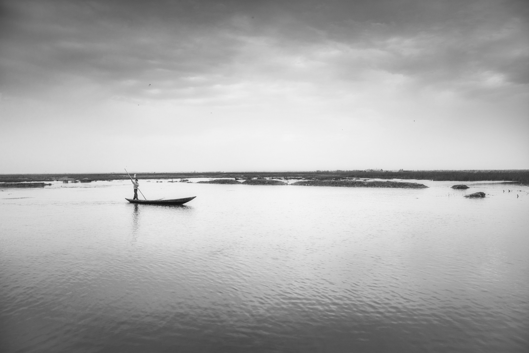
The Lagash region included waterways, marshes, settlements and cultivated land. Research at ancient Lagash places canal connections within an economy that also used wetlands, fishing and pastoral resources. The landscape supplied more than grain. Waterways could connect settlements and carry goods as well as serve fields. The Lagash study helps explain why a canal belongs in a wider working landscape.
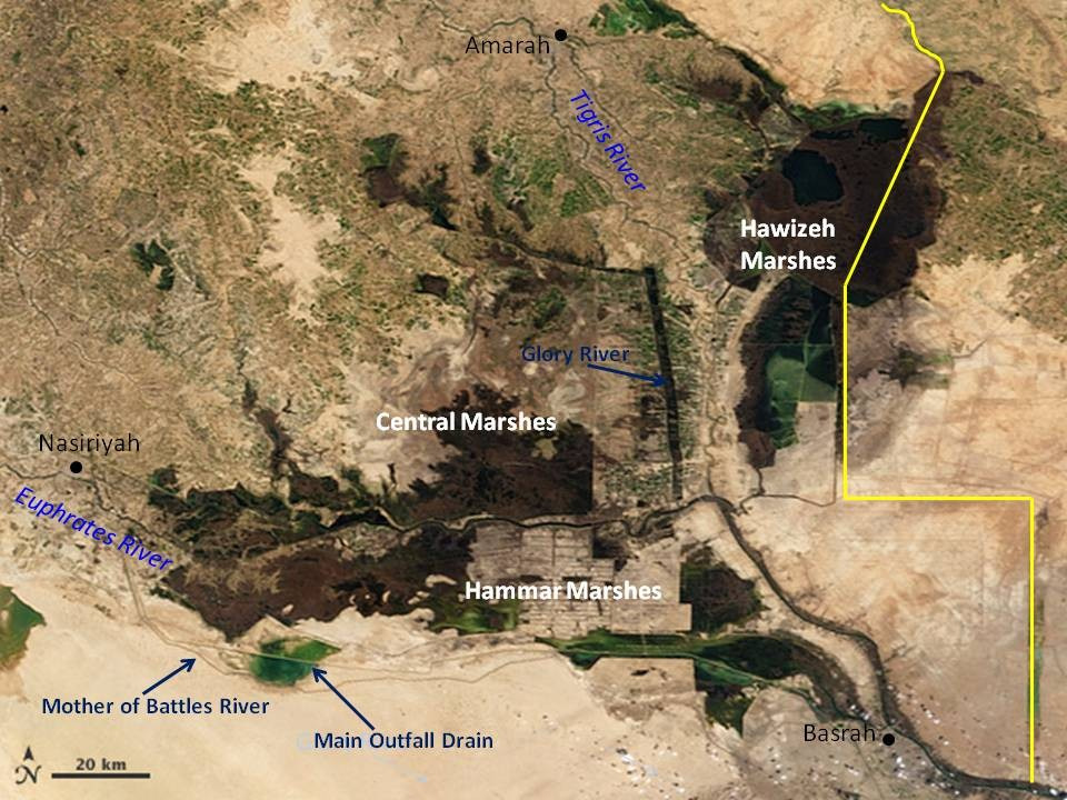
This modern satellite view gives geographical orientation. It cannot show where a channel ran in 2400 BCE: rivers move, channels fill and people reshape drainage. For the ancient route, we need archaeological evidence and written records together.
Follow the water through the network
The essential mechanism was gravity: water flows from a higher level to a lower one. Where river levees provided an elevation advantage, a channel could carry water onto lower land. A working route needed a suitable gradient and controlled connections. An impressive canal elsewhere offered little help to a field whose own distributor was blocked.
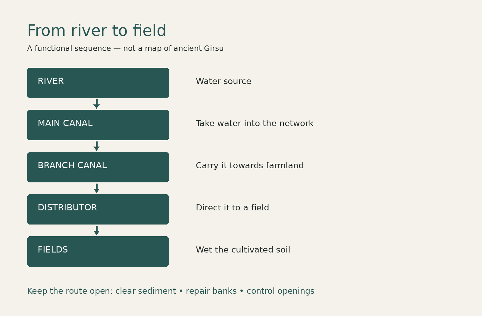
Read the diagram from top to bottom. The river supplies water; a main canal carries it into the network; branches bring it closer to farmland; smaller distributors let it reach particular fields. These are functional roles. The diagram is not the traced plan of a surviving ancient system. Schrakamp’s study of Early Dynastic Lagash provides the historical network hierarchy.
Getting water in was only half the task
More water is not automatically better. Water held in the wrong place can damage banks or leave soil waterlogged. Irrigation therefore involves managing entry, movement and removal. A channel needs enough capacity for its task, while banks and openings must direct flow rather than let it escape wherever the ground gives way.
A useful way to imagine the work is to start at a dry field and move upstream. Is its opening usable? Is the distributor clear? Is its branch receiving water? Does the main canal connect to a usable supply? This is a diagnostic exercise, not a recovered ancient instruction manual. It shows why maintenance had to connect across different scales.
TERMS TO KEEP
Three parts of the job
Distributor
A smaller channel that directs water towards individual fields.
Bank or dike
An earth boundary used to contain or direct water. Damage can change where water goes.
Corvée
An obligation to supply labour. In the Lagash evidence, access to institutional land could carry canal-work duties.
Who did the work? Follow the obligations.
The surviving Lagash records do not describe one permanent workforce doing everything. Schrakamp distinguishes major works mobilised by rulers from maintenance organised within temple estates. People drawing subsistence from allotted institutional fields could owe labour. Their other occupations included farming, herding, fishing and crafts; canal work was not simply the job of a separate class of diggers.
Administrative texts assigned measured stretches of work. In DP 615, for example, the maltster Nammahne is assigned one reed, about three metres, while the goat-herd Urdumuzi is assigned one rope, about thirty metres. These are length allocations, not proof that one person worked ten times as long: difficulty also depends on the job and the condition of the channel. The record makes an obligation measurable without giving us every working detail.
That distinction matters. A roster can tell us who was assigned work, yet leave unanswered how a worker felt about it, whether the assignment was contested or exactly how the task was performed. We can reconstruct an administrative arrangement more confidently than an individual working day. See Schrakamp (2018), especially the canal-work records.
Where would you send the workers first?
MAKE A CHOICE
One crew, three competing repairs
Imagine a shared canal network. Its main channel has narrowed with sediment, a bank has a weak patch, and one field distributor is blocked. You have enough workers to tackle one job first.
Compare the priorities. The best choice depends on conditions you would need to inspect.
Clear the main canal
- Benefit
- If this is the bottleneck, many downstream users could gain a usable supply.
- Trade-off
- A blocked field distributor would still prevent water reaching that field. A weak bank may remain exposed.
- Who decides
- A coordinator needs to compare the shared obstruction with local needs and the risk of bank failure.
What does the historical evidence add?
Lagash records show labour obligations and measured work allocations. They support the importance of organised maintenance, but do not tell us which repair our invented crew should choose. First identify the bottleneck, then ask who bears the work and who receives the benefit.
An invented thought experiment about connected maintenance, not a documented decision at Girsu. No ancient numbers or flow rates are implied.
A water dispute is also a dispute over authority
Shared connections create shared vulnerabilities. Imagine two groups using the same branch. An upstream opening affects what remains downstream; a repair on one reach may benefit users who did not supply its workers. Those are deductions from how a connected system works. A particular ancient conflict still needs its own evidence.
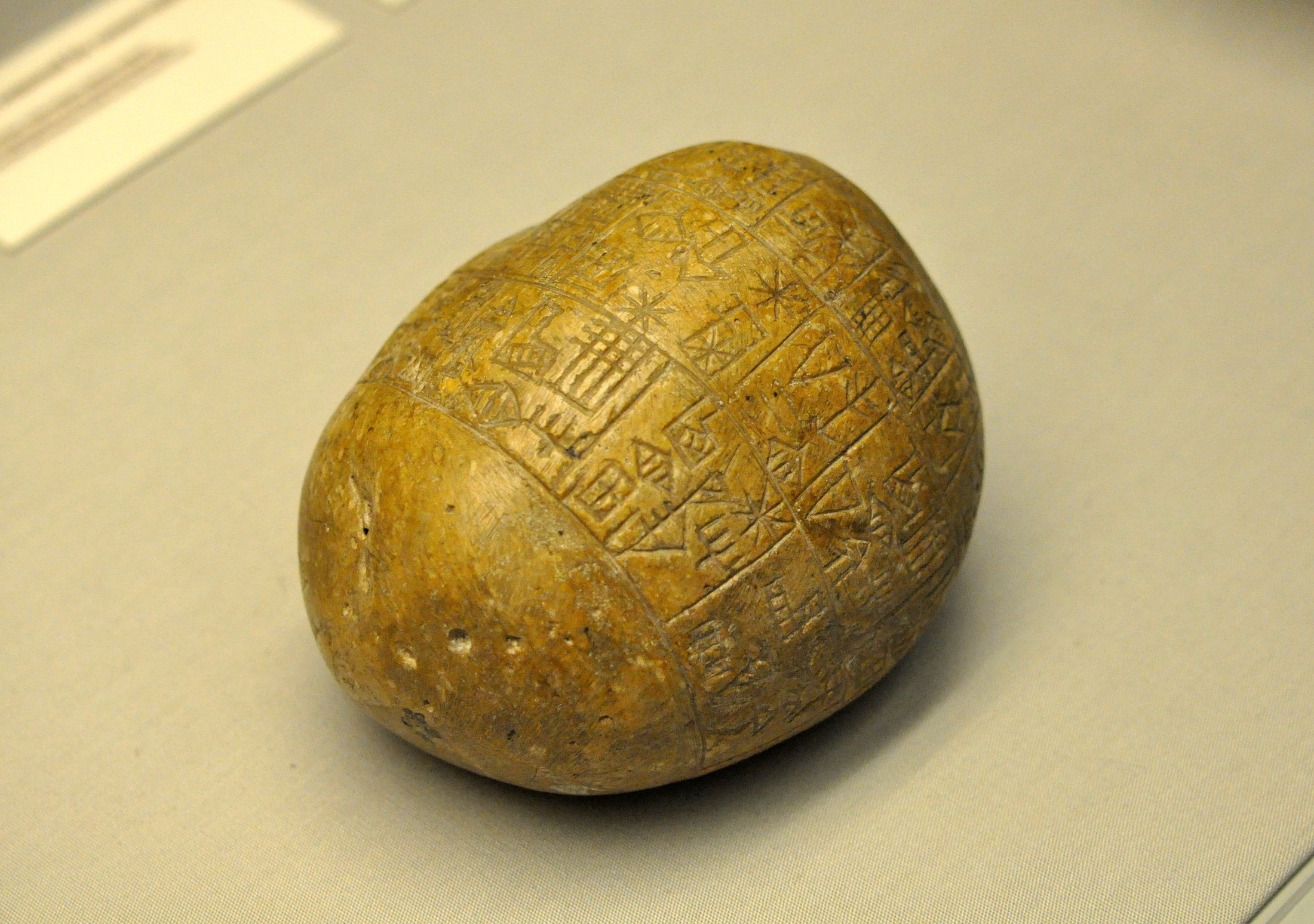
A royal inscription of Enmetena of Lagash supplies a specific, partisan example. It describes a conflict with Il of Umma over a boundary channel associated with Ningirsu and Nanshe, including rival claims about water and a boundary levee. The text places access to water within a dispute over land and rightful control. Its account also serves the ruler’s claim to legitimacy.
The alleged words of the opponent appear inside Enmetena’s account; they are not an independently preserved statement from Umma. We can use the inscription as evidence that water rights mattered in this conflict without treating its narration as a neutral transcript. See Sallaberger and Schrakamp (2015), p. 77, RIME 1.9.5.1 iii 38–iv 10.
This does not establish that irrigation always produced the same political system. Rost’s review of Mesopotamian water management stresses variation in institutional involvement across periods. The more useful question is specific: who could organise a given channel, require labour and decide access in this place and time?
How do we know when a canal was used?
An administrative text and a buried channel answer different questions. A text may name a work obligation; a channel section preserves physical deposits. Neither automatically gives a complete network or the date when its first builders began digging.
At Tello/Girsu, Egberts and colleagues investigated seven ancient channels using archaeological evidence and radiocarbon samples. The important trap is to confuse a sample’s date with the construction date of the canal. A charcoal fragment in a deposit helps date material in that deposit. Its relationship to digging, flowing water and later filling must be interpreted from context.
The study also found that freshwater shell dates can appear too old because of a reservoir effect. Putting two sample ages beside each other is therefore not enough: researchers must consider what was sampled and how it acquired its carbon. The Girsu canal-dating study shows why a precise-looking number still needs an explanation.
| Evidence | What it can show | What it cannot supply by itself |
|---|---|---|
| Administrative allocation | Assigned workers or measured work | Every action, feeling or outcome |
| Royal inscription | A ruler’s claim about water and authority | A neutral account agreed by both sides |
| Channel deposits | Physical sequences and dateable material | An automatic date for first construction |
The city depended on connections beyond its walls
Return to the field. Its crop depends on the soil receiving water, but also on an opening, a distributor, a branch and a shared supply. Each connection adds a maintenance task. Each task raises another question: who supplies the labour, and who has the authority to organise it?
For Early Dynastic Lagash, canal records and royal claims bring those questions into view. The central insight is practical: irrigation was a continuing relationship between water, land and organised work. Digging a channel established a route; keeping that route usable demanded repeated attention.
The same waterways also make the next question possible. If channels carried water to fields and connected settlements, how did goods and people move through the wider landscape? That is the next step in the First Cities story.